ZIP Code 17007 | Guatemala
The ZIP Code 17007 belongs to the district Santa Ana in the province of Petén. Check out below the map to see what zone is included in this ZIP Code.
The postal zone 17007 has an area of 1488.65 km2 and a perimeter of 200.97 km. This postal area is located between latitudes 17.0163 and 16.6452 and longitudes -89.8643 and -89.3305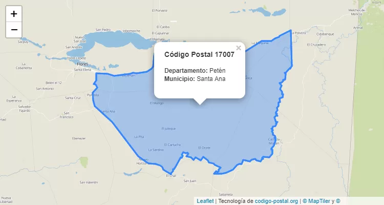
Postal Code Santa Ana
The city Santa Ana belongs to the canton Santa Ana. For other districts, go back to Santa Ana ZIP Code and find the corresponding district.
State Petén
The canton Santa Ana belongs to Petén. Enter the specific page for Petén ZIP Code to view all cantons of this province.