ZIP Code 12029 | Guatemala
The ZIP Code 12029 belongs to the district San Lorenzo in the province of San Marcos. Check out below the map to see what zone is included in this ZIP Code.
The postal zone 12029 has an area of 44.83 km2 and a perimeter of 28.62 km. This postal area is located between latitudes 15.0562 and 14.9946 and longitudes -91.7932 and -91.6992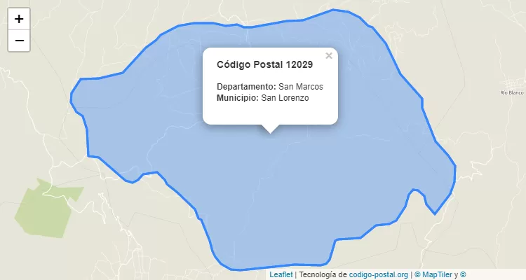
Postal Code San Lorenzo
The city San Lorenzo belongs to the canton San Lorenzo. For other districts, go back to San Lorenzo ZIP Code and find the corresponding district.
State San Marcos
The canton San Lorenzo belongs to San Marcos. Enter the specific page for San Marcos ZIP Code to view all cantons of this province.